Why Choose Us
We are the best in the fishing industry!
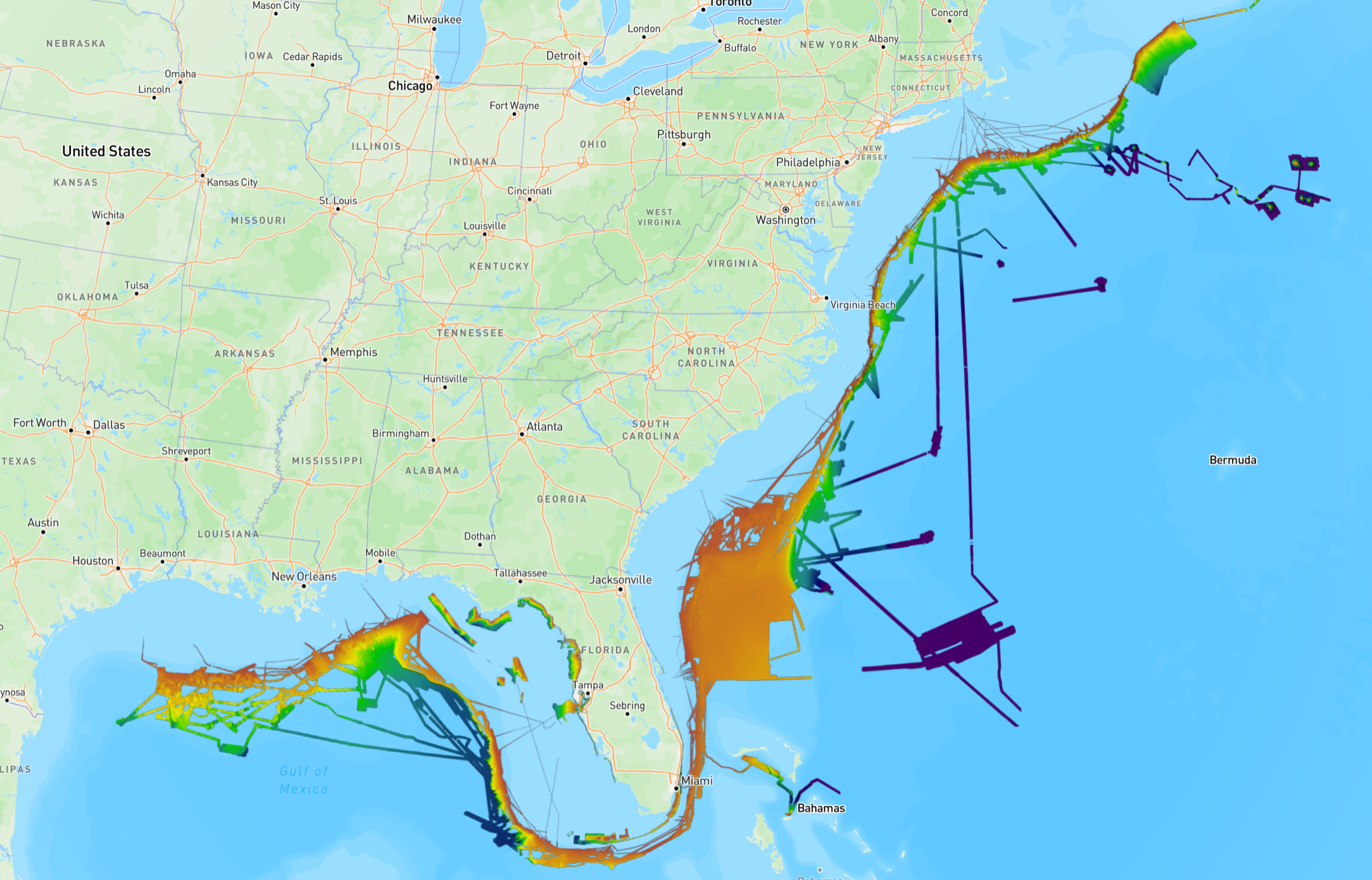
All Data in One Place
With YourBit, maps are not sold piece by piece. One subscription gets you full access to all currently available, and future, bathymetric data.
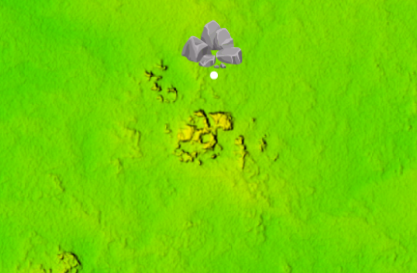
Multiple Color Schemes
Our maps are not limited to a single color ramp. We feature a standard rainbow relief, a blue relief, and a white relief. Together, these shades hide the weaknesses of each other to capture every detail of the sea floor.
Custom Download Maps
When its time to head offshore, build your own map. You get to choose what areas you want and in what colors. There is “no one size fits all” with YourBit.
How it Works
Say goodbye to managing SD cards and device compatibility issues.
Research
Research and plan your trip ahead of time. Mark structure you want to visit tomorrow from the comfort of your home today.
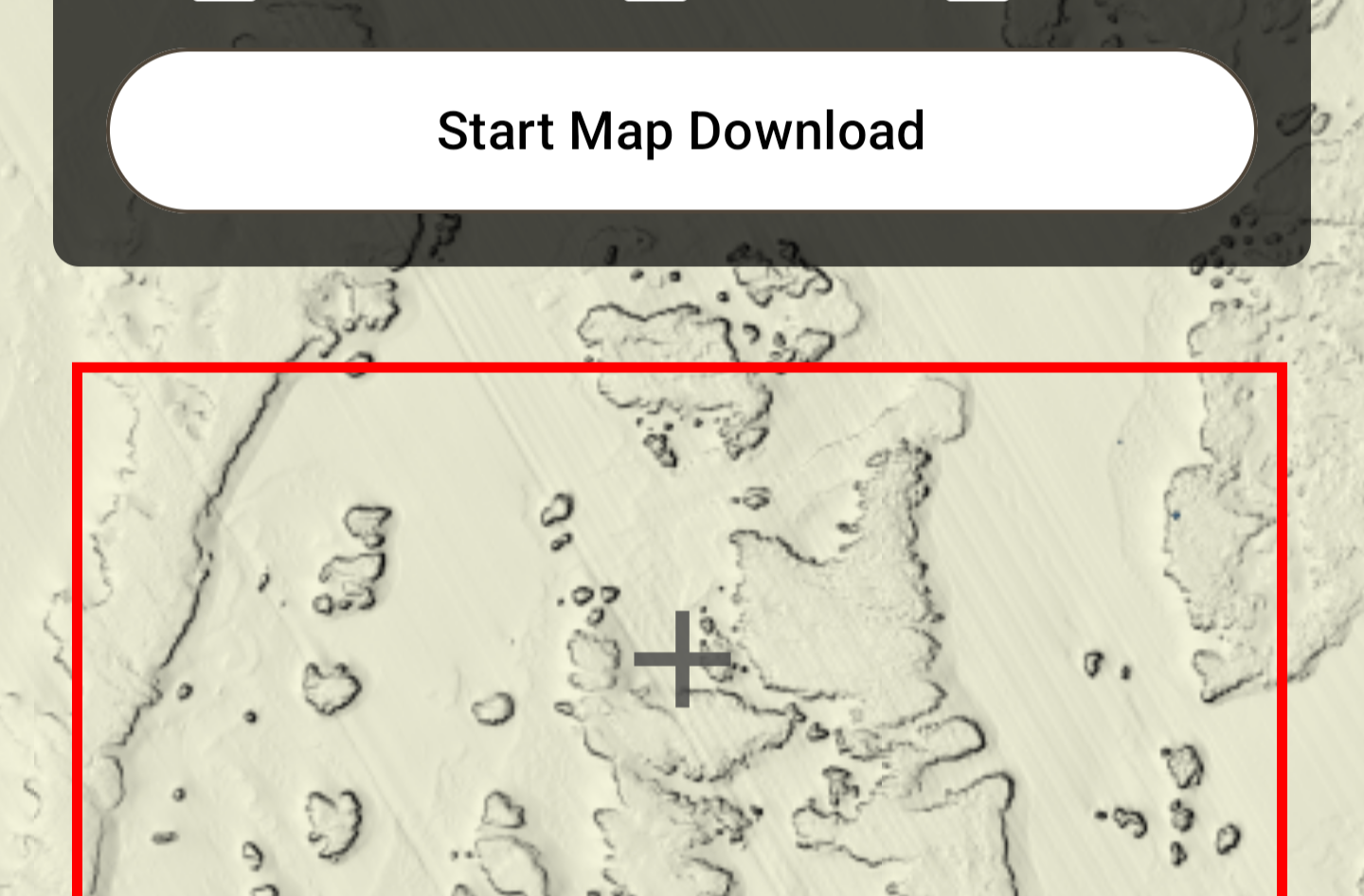
Download
Download custom regions of data onto your phone or tablet to bring with you offshore.
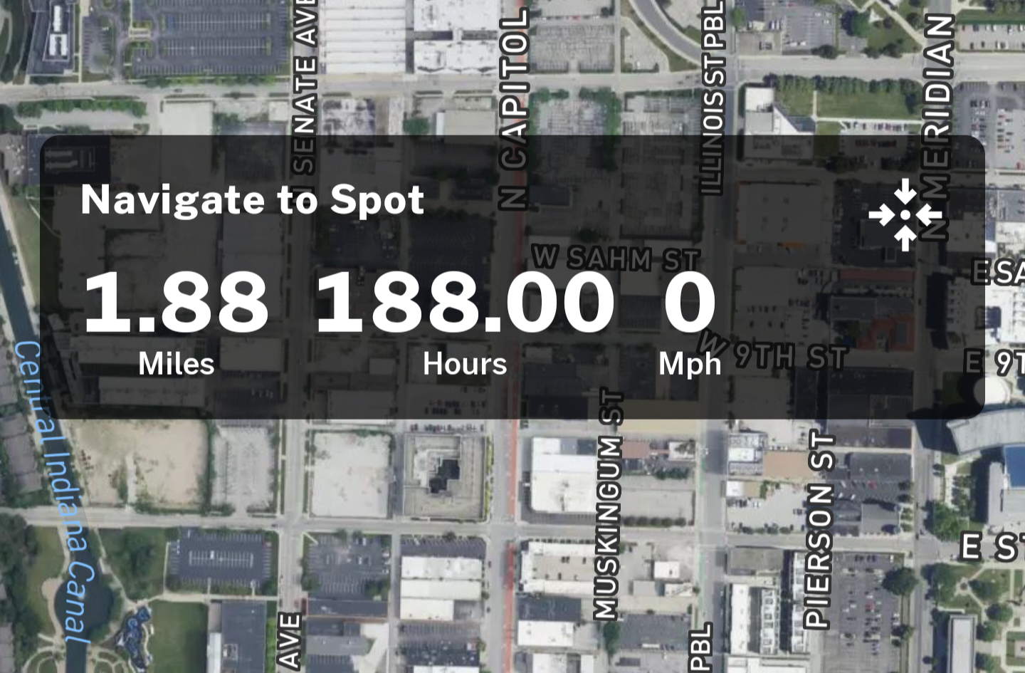
Navigate
Use in-app navigation to lead you to your downloaded maps and waypoints.
Instantaneous Map Updates
With our cloud based system, waiting around for a card upgrade is a thing of the past. When new data comes out, you’ll be the first angler there. No upgrades, no new cards, no fees. Just more data.
The Modern Fishing Experience
Take the first step towards an unforgettable fishing experience with YourBit.
Read Our Customers’ Words
Hear from our satisfied customers about their experience with YourBit.
I couldn’t believe how clear the data was. Rocks, reefs, and ledges are obvious. The guess work is gone.
Exceptional Detail
I had to upgrade my fishfinder just to get my card to work somewhat reliably. YourBit removed the uncertainty. It just works. I never have to worry.
Easy to Use
I spent over $1,000 on chips before I foundYourBit. With one subscription I now have data for everywhere I could ever fish.
Affordable
F.A.Q.
Frequently Asked Questions
Yes. All spots you mark are synced across your devices. Mark a spot on your computer and it’ll show up on your phone 50 miles offshore.
YourBit supports both iOS and Android. The app can be downloaded on any mobile device such as phones and tablets. You always have access to your maps any time via the website’s interactive map.
Yes. Maps can be deleted off your device. You can even choose specific color schemes to delete. You can redownload your map at anytime.
Yes. With an HDMI cable, you can display your map right on your fishfinder the same way you would to watch a football game on your finder.
Data becomes available to you as fast as its processed. YourBit offers the fastest data distribution system on the market. You can expect to see new data on your app in a matter of days after its released.
Yes. StarLink eliminates the need to download maps at all. The app will work the same whether you’re on your couch or out at sea.